
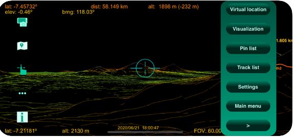
Here is an augmented reality app that lets you use your iPhone to scan the world around you to get distances, coordinates, and slope of anywhere around you. ScanEarth uses data from your phone’s GPS, gyroscope, and magnetometer to display data on your screen. The data is updates in real-time as you move your phone.
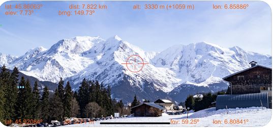
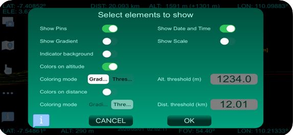
ScanEarth generates accurate virtual images and merges them with reality to display slope, elevation, distance, and other information for your target. You can always change which elements to show.
Vibe coding is all the rage these days. You can get started with Cursor, Windsurf,…
Meet the Lockly Visage Zeno Door Lock: an iPhone compatible lock with app connectivity and…
Here is another iPhone stand that takes your selfies to the next level. The Hokolite…
Keeping your pool water clean takes work. You will need the right tools to clean…
Here is another iPhone SSD that expands its storage. The Aiffro P08 is a magnetic…
Cats are amazing creates to have around. They have to pee and poop daily, which…


