ScanEarth Augmented Reality Geo Scanner
0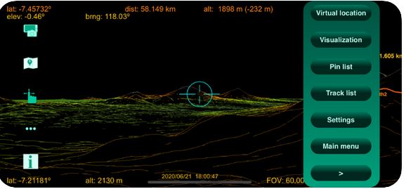
Here is an augmented reality app that lets you use your iPhone to scan the world around you to get distances, coordinates, and slope of anywhere around you. ScanEarth uses data from your phone’s GPS, gyroscope, and magnetometer to display data on your screen. The data is updates in real-time as you move your phone.
Top iPhone & iPad cases & accessories
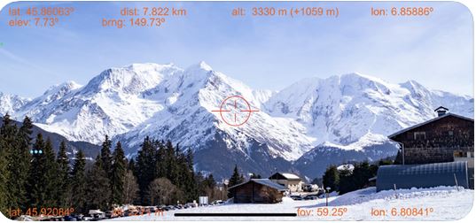
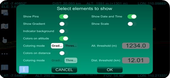
ScanEarth generates accurate virtual images and merges them with reality to display slope, elevation, distance, and other information for your target. You can always change which elements to show.
**Disclaimer: Our articles may contain aff links. As an Amazon Associate we earn from qualifying purchases. Please read our disclaimer on how we fund this site.

