Drones are becoming smarter and more affordable all the time. Before flying one, you will need to do your homework to make sure you don’t enter a no-fly zone. Here are 4 iPhone apps with drone no-fly zone maps that help you stay out of trouble:

UAV Zones: this iPhone app displays no-fly zones for drones with black polygons. It can also show weather information for your selected areas. It covers most US Airports, National Parks, and military bases.
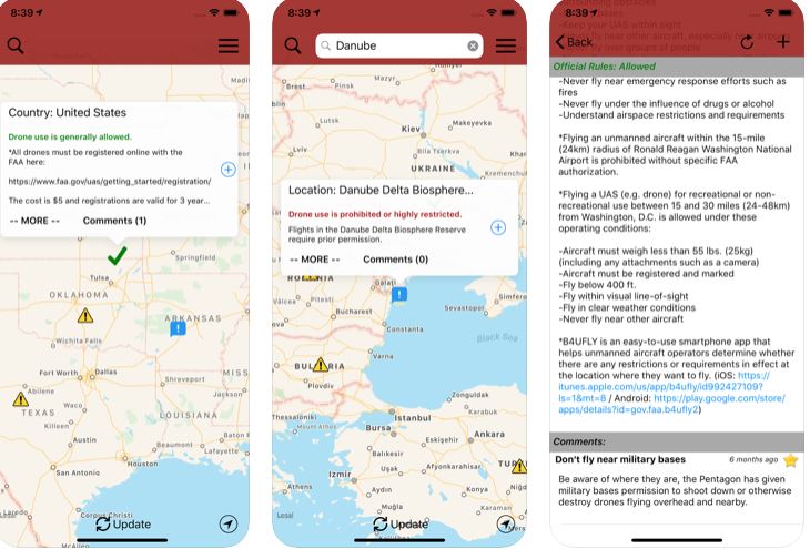
DroneMate: a drone laws app for iPhone and iPad helps you stay out of trouble. It pulls information from official sources. It shows you where you shouldn’t fly your drone and has a comment system to keep you in touch with other drone pilots.
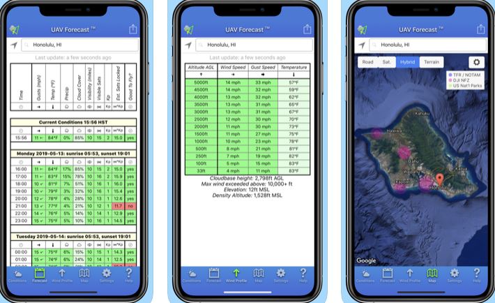
UAV Forecast: a this app provides UAV pilots with weather forecasts, solar activity, flight restrictions, and another necessary information. It is ideal with DJI Phantom and other comparable quadcopters.
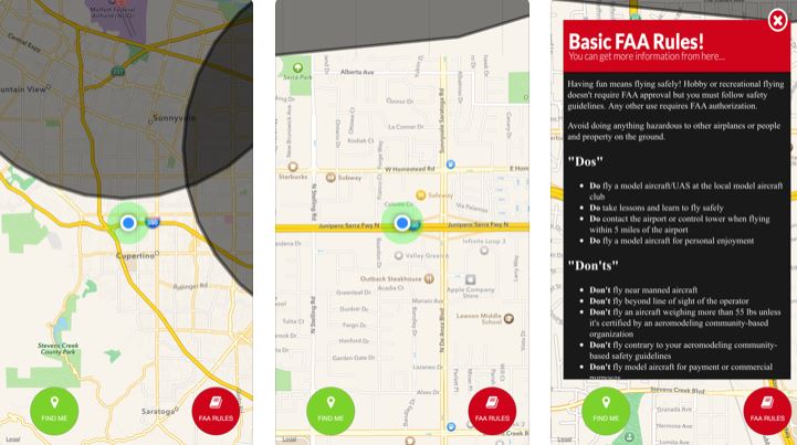
Drone Buddy: an iPhone app built for drone pilots. It shows weather and no-fly zone info to help you fly with more confidence. Drone Buddy shows KP index, visibility, cloud cover, UV index, and local sunrise and sunset time for your location.
Have you found better iOS apps with no-fly zone maps for UAVs? Please share them here.
This is the DREAME Z1 Pro: a robotic pool cleaner that gets rid of leaves…
iPhone compatible treadmills are nothing new. We have covered a bunch of them here in…
Meet the Living Lights Lotus: a motion enabled light that gives your place a more…
In this day and age, we all use a power bank or two to keep…
Meet the Ring Mouse: a Bluetooth ring-shaped mouse that you can use to view recipes,…
Leonardo is one of the most popular AI image generation tools around. It has added…


