10 Top Outdoor GPS Applications for iPhone
9If you happen to have spent a bit of time in the wild, you probably appreciate the luxury of having an outdoor GPS when you are out exploring new areas. You never know what happens when you go hiking, camping, or climbing, and it doesn’t take much to get lost. Some of us are obviously better than others in finding our way outdoors. But for the rest of us outdoor GPS solutions come in handy.
Thanks to Apple and the iPhone developer community, you won’t have to spend a few hundred dollars on an outdoor GPS. You can just use your iPhone to get the job done (don’t forget your iPhone battery extender). In fact, here are 10 outdoor navigation apps for iPhone that make you forget about those good old outdoor GPS units altogether:
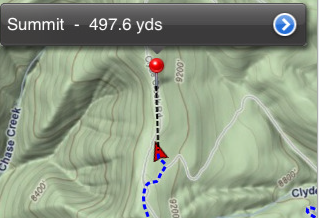
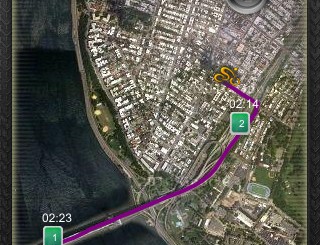
GPS Kit: comes with easy to follow maps (with caching), GPS, track recording, and track sharing capabilities. One of the best navigation apps on the market.
MotionX GPS: one of the most popular navigation solutions for iPhone. It’s a comprehensive solution for those who spend a lot of time outdoors. Gives you all the satellite and topo maps you need to get on with your life outdoors.
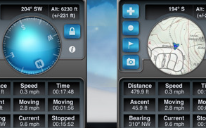
Gaia GPS: turns your iPhone into a complete GPS solution for hiking, biking, skiing, and even driving. It can record your records as well.
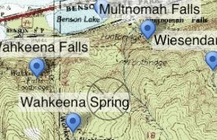
iTopo Maps: a complete outdoor GPS solution for hikers and climbers. Very flexible and covers all 50 states.
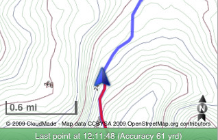
Trails – GPS Tracker: helps you keep track of your activities outdoors. Whether you want to record your hikes, bike trips, or jogs, this app gets it done. You can export and edit your tracks too.

Sun Compass: it’s a cool little app that uses G-map to help you figure out where you are and the compass will show you which direction you need to walk to.

Park Maps: it’s a GPS enabled map solution that covers over 250 U.S. national parks, recreational areas, and more. Good choice if you are into exploring cool areas.
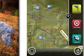
AccuTerra: a free (upgradeable) outdoor GPS application for iPhone that provides you with the maps you need to explore new areas.
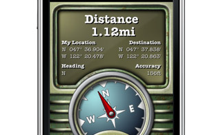
Geocaching: geocaching is a lot of fun and even if you don’t know what it is, you’ll come around as long as you are into hanging outdoors. This app helps you access over 950,000 geochaces around the world on your phone. Very impressive.
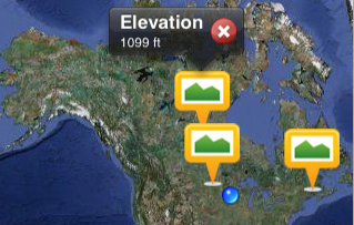
Elevation Pro: it’s a mobile altitude tool for those who do a lot of climbing. It comes integrated with Twitter and Google Maps.
Did I miss any? Feel free to add your favorite outdoor GPS apps in the comment section.




I would also recommend
GPS To SMS
to share your location
http://gps-to-sms.blogspot.com/
Thanks for suggestions. But for hiking off the beaten track, the viewranger app wins for me – it lets you share your location in real time on an OS map, on top of all the standard GPS functions.
Check the
Way Home Finder
App
Perfect for offline usage
http://itunes.apple.com/us/app/way-home-finder/id…
I'd like to recommend GPSies+ (free, see http://iphone.gpsies.com/) with over 850.000 outdoor tracks on maps of OpenStreetMap. Good for cycling, trekking or running.
can anyone recommend a good sail app, giving speed in knots and course made good?
Does anyone know if any of these GPS apps calculate can acreage?
the apps of komoot are outstanding. Best Maps, best Routing i´ve seen so far. Unfortunately currently available only for europe.
Thanks for your post! I've tried some of these apps before, and I've also been pretty impressed with the "Galileo Offline Maps" app for my outdoor ativities.
The maps are very fast, allows to record GPS tracks and export them.
In combination with Mobile Atlas Creator this does exactly what I wanted – you can download from pc any kind of map from several map sources on the internet and import them in your iphone, where they work flawlessly, offline of course.
Great for carrying hiking maps. http://itunes.apple.com/us/app/galileo-offline-ma…
I know people have asked this, but what happens in back country with no cell service?